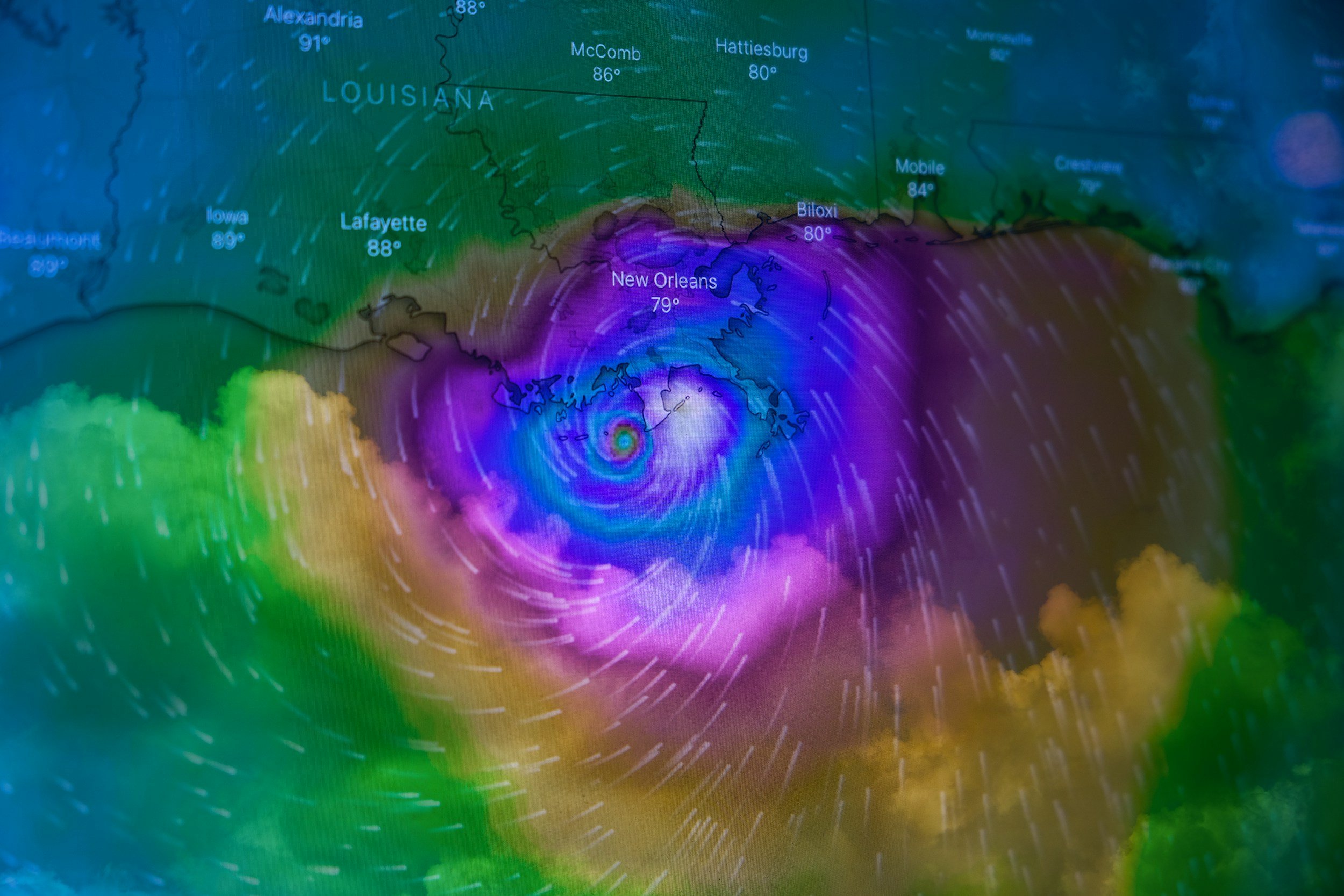
NASA and NOAA Enhance Hurricane Prediction Through Advanced Data Collection and AI Innovation
Image Credit: Carl Kho | Unsplash
As climate change intensifies, coastal communities are increasingly vulnerable to more frequent and severe tropical cyclones and hurricanes. The escalating threat underscores the urgent need for enhanced predictive tools to accurately forecast storm intensity, trajectory, and timing, as well as to assess post-disaster damage effectively. In response, NASA (National Aeronautics and Space Administration) and NOAA (National Oceanic and Atmospheric Administration) are at the forefront, employing cutting-edge technologies and collaborative efforts to bolster hurricane prediction and disaster response capabilities.
[Read More: The Future of Earth System Science: Embracing AI for a Sustainable Planet]
On the Front Lines of Hurricane Monitoring
NASA and NOAA leverage both aerial and satellite platforms to gather critical data as hurricanes develop and approach landfall. Central to these efforts are the daring hurricane hunter pilots, such as Dean Legidakes, who undertake perilous missions to fly directly into the heart of storms. Operating from the NOAA Aircraft Operations Center in Lakeland, Florida, these pilots navigate state-of-the-art P3 Orion turboprop aircraft, named Kermit and Miss Piggy, equipped with sophisticated meteorological instruments. Their missions involve multiple flights into the storm to collect data that satellites alone cannot capture, providing invaluable insights into storm dynamics.
[Read More: Google's FireSat: Harnessing AI Satellites to Combat Australia's Bushfire Crisis]
The Perilous Journey of Hurricane Hunters
Flying into a hurricane is a high-risk endeavour that requires exceptional skill and resilience. Pilots like Dean Legidakes describe the experience as akin to riding a "roller coaster through a car wash", with intense turbulence, heavy rainfall, and the constant threat of lightning strikes. The aircraft must maintain low altitudes, typically below 8,000 feet, to avoid icing conditions, making each mission a test of both piloting expertise and technical endurance. Despite the challenges, these missions are crucial for obtaining real-time data on storm intensity and structure, directly influencing the accuracy of forecasts and the safety of affected communities.
[Read More: The Forecast Revolution: How AI is Reshaping Weather Predictions]
NASA’s Prithvi Weather and Climate Model
In an innovative leap, NASA has developed the "Prithvi Weather and Climate AI model", a foundational AI tool designed to analyze extensive Earth science data. Led by Rahul Ramachandran from NASA’s Office of the Chief Science Data Officer, this model leverages artificial intelligence and neural networks to identify patterns within vast datasets, enhancing the predictive power of hurricane forecasting. Unlike traditional physics-based models, the Prithvi model can process data more efficiently and may uncover previously unknown factors influencing storm behaviour. Initial tests indicate that this AI-driven approach outperforms existing models in forecasting both the track and intensity of hurricanes, offering a promising supplementary tool for meteorologists.
Democratizing Access to Critical Data
NASA’s commitment to open science ensures that the wealth of data collected from satellites and field missions is freely accessible to the public and scientific community. Under the leadership of Kevin Murphy, NASA’s Chief Science Data Officer, the Transform to Open Science (TOPS) program emphasizes the four pillars of open science: immediate data availability, open software, unrestricted access to scientific publications, and public participation in the scientific process. This open-access approach not only fosters collaboration and innovation but also empowers citizen scientists and researchers worldwide to contribute to and benefit from NASA’s extensive data repositories.
[Read More: Smart Cities: Pioneering Sustainable Urban Living in the Digital Era]
Disaster Response and Recovery
Beyond prediction, NASA plays a pivotal role in disaster response and recovery through its Disasters Response Coordination System (DRCS). When disasters such as hurricanes strike, NASA collaborates with government agencies like FEMA (Federal Emergency Management Agency) and nonprofits to provide real-time data and mapping services. For instance, during Hurricane Beryl in July 2024, NASA’s nighttime power outage maps enabled emergency responders to identify and prioritize areas most in need of aid. Similarly, in the aftermath of Hurricane Milton in October 2024, NASA utilized satellite imagery and unmanned aircraft to assess damage and coordinate recovery efforts, demonstrating the critical importance of timely and accurate data in mitigating disaster impacts.
[Read More: Can AI Predict the Unpredictable?]
Impact of Climate Change
Climate change continues to drive unprecedented shifts in our environment, with rising sea surface temperatures (SSTs) playing a pivotal role in the intensification of hurricanes. Warmer waters provide the energy hurricanes need to grow more powerful and develop more quickly.
These intensifying storms present significant challenges for prediction and response efforts, especially as the frequency of such events increases. NASA’s innovative integration of AI models with traditional forecasting methods aims to address these challenges, offering improved accuracy and faster predictions. By combining cutting-edge technology with data-driven insights, these advancements are enhancing preparedness and resilience for vulnerable coastal communities worldwide.
Warm Water Trends and Climate Impact
The historical data on SSTs offers vital insights into the changing climate. Over the past four decades, the average SST over the extrapolar ocean has risen by approximately 0.6°C, with a total increase of about 0.9°C since the pre-industrial era. These changes, documented since the mid-19th century through ship observations and later through satellite and buoy measurements starting in the 1980s, highlight the profound impact of warming oceans on global weather patterns.
Key events such as the strong El Niño of 2015–2016, followed by a decade of La Niña-dominated conditions, culminated in a shift back to El Niño in 2023. These oscillations significantly influence atmospheric circulation, rainfall distribution, and the frequency and strength of tropical cyclones. The top few meters of the ocean store as much energy as the entire atmosphere, underscoring the importance of monitoring SSTs for climate science and weather forecasting.
Image Source: Copernicus
SST measurements are essential for tracking phenomena like marine heatwaves, ocean fronts, and upwelling regions, which impact both short-term weather predictions and long-term climate models. Understanding these trends allows scientists to refine predictive tools, offering better insights into how warming oceans energize tropical storms. This knowledge is crucial for developing strategies to mitigate the growing risks posed by climate change on coastal communities.
[Read More: United by AI: 20 Drones Join Forces to Battle Wildfires]
Source: NASA, Copernicus


